Maps
The purpose of the GCH has been to classify all areas of Aotearoa/ New Zealand as rural or urban according to their proximity to larger urban areas employing population and drive time that are meaningful with respect to health.
For an interactive view of the GCH maps, please click here.
Scroll down for PDF downloads of North and South Island maps.
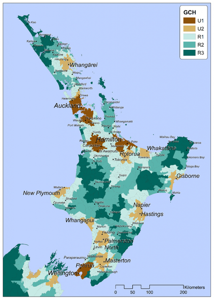
North Island / Te Ika-a-Māui
U- Urban Categories 1-2. 1 being the most urban.
R- Rural Categories 1-3. 3 being the most rural.
Click on the PDF file below to view this map in more detail.

South Island/ Te Waipounamu
U- Urban Categories 1-2. 1 being the most urban.
R- Rural Categories 1-3. 3 being the most rural.
Click on the PDF file below to view this map in more detail.